
Here is a throw-back to a crazy storm and a crazy thing I did… drove way too close to the action! It started out with a tornado-warned storm moving east thru Linn, MO. I setup on the side of Highway 50 and captured a few late-daytime bolts in one 20 second exposure. Then the storm weakened and the warning was dropped, so I retreated back towards home (which was basically the direction the storm was heading anyway).
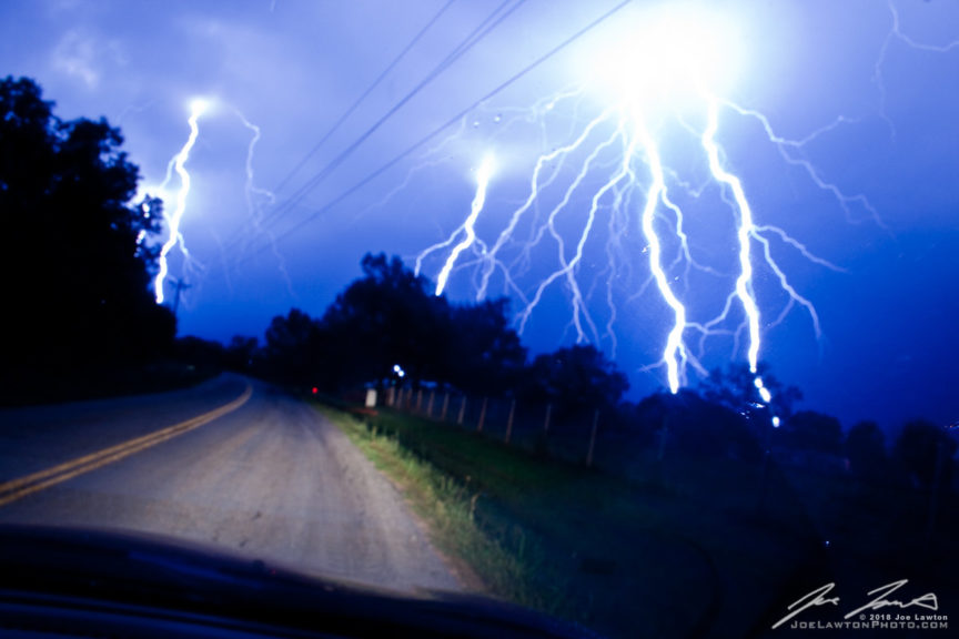
About 20 minutes later a new tornado warning was issued for the same storm, now approaching Drake, MO and continuing east. Only being 5 miles away, I headed back to get a better visual, and ended up driving right into the middle of it. Basically I stopped in the middle of the road and took a picture from the tripod-mounted camera sitting in the passenger seat. I was actually worried about the car getting hit on my scanner antenna by the lightning as it was well within 1/2 mile range.
Then moving up to the next county road, taking a few shots from a semi-safer location, trying a long exposure looking for any wall clouds hanging down. Rotation wasn’t evident as it was now dark, and the lightning was moving out ahead of the storm, so I started my attempt to head back. While driving back, the wind & rain became very intense, coming from the west at one point, then shifting from the east, then going back west. I couldn’t determine if it was weak rotation, RFD, or just the crazy turbulence, so I opted to get out of there and retreat to a safer location.
Side note, I didn’t have a smart phone at that time so I had no radar support, just a weather radio and the camera. Looking back, I wouldn’t begin to try to intercept something like that now without some sort of data feed. It’s just not worth it.

 " data-envira-height="200" data-envira-width="300" />


